
A Big-Picture View of the Invasive Plant Problem
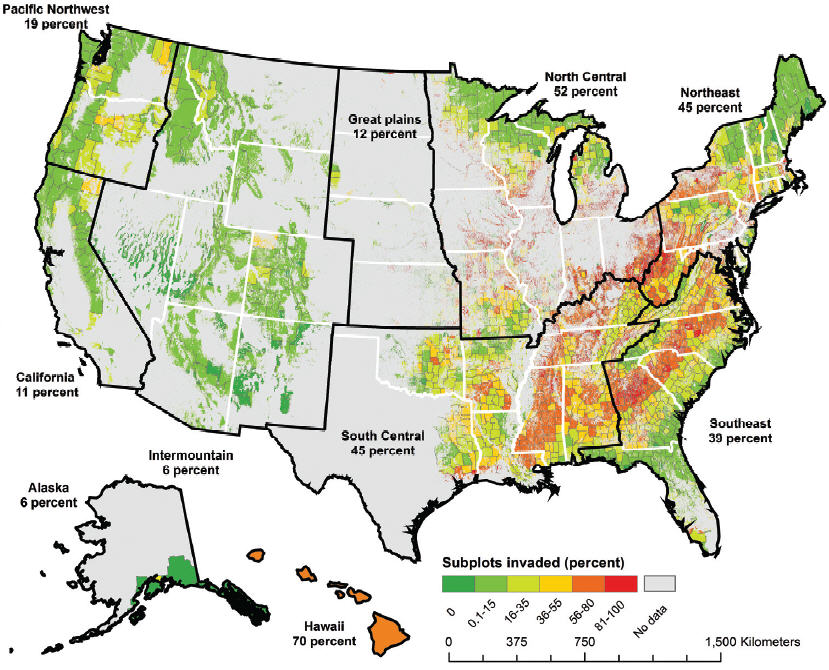 Invasive plants are increasingly altering the structure and function of our natural environment, and now researchers have determined how far-reaching the problem has become. According to a study conducted by Southern Research Station and university scientists and published in the journal NeoBiota, at least one invasive species is present in 39 percent of forested plots sampled nationwide for invasive plants by the Forest Service Forest Inventory and Analysis (FIA) program. Results are provided for all U.S. regions and reveal that a significant portion of the more than 741 million acres of forested land in the United States has been invaded. The researchers created a U.S. map of invasion-intensity to illustrate the extent of the problem and help inform management actions across the landscape. “For this study, our intention was to let people see how large data sets can be used to understand macro-scale issues and monitoring forest invasion. This broad-scale study gives us a wider perspective that one can’t get from local studies,” says Qinfeng Guo, Eastern Threat Center research ecologist and a co-author of the study. Read more in CompassLive...
