A national tool for understanding the importance of forests for drinking water gets a major overhaul
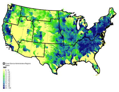
Forests play a crucial role in protecting and enhancing the nation's drinking water supply. Since 2011, the US Forest Service's Forest to Faucets program has provided a unique tool for understanding and mapping this forest ecosystem service and threats posed by multiple stressors. Now, State and Private Forestry's Chesapeake Watershed Forestry Program has partnered with the Southern Research Station's Eastern Forest Environmental Threat Assessment Center in a major effort to update this important source of national information. Forest to Faucets 2.0 expands on the original assessment with updated data and considers additional threats to watersheds important to surface drinking water. The website went live to the public in April 2020. The assessment uses Geographic Information Systems (GIS) to help users understand, through intuitive online visual mapping tools, how important small watersheds are for surface drinking water across the country. The vital role forests play in protecting source water is embedded in the data, which measure the extent to which forests are threatened by development, insects and disease, wildland fire, and climate change. Visit the Forest to Faucets site to learn more about the assessment and to access the interactive map viewer.