
Habitat Distribution Emerges with a New View of the Forest Canopy
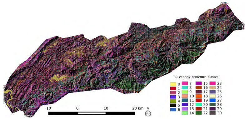 Researchers working at the Eastern Threat Center's office in Asheville, North Carolina, are just a short drive away from one of the most biodiverse places on the planet: the Great Smoky Mountains National Park, which straddles 800 square miles of western North Carolina and eastern Tennessee. Although they and nearby collaborators at Oak Ridge National Laboratory (ORNL) have visited the park many times, they are now seeing its forest cover in a way they’ve never seen it before. Along with researchers from the University of California, Berkeley and the U.S. Fish and Wildlife Service, they’ve devised a technique for crunching large volumes of data from Light Detection and Ranging, a remote sensing method known as LiDAR, to map and characterize the vertical structure of the forest canopy in the Tennessee side of the park. "Vertical distribution of the forest structure is a vital characteristic of the forest itself, as well as an important characteristic of the forest habitat for many species of plants, birds, and other animals,” says Center research ecologist Bill Hargrove. As the Great Smoky Mountains National Park and other U.S. landscapes face a variety of threats, forest structure maps can highlight changes in the richness and distribution of habitat to help forest and natural resource managers monitor, manage, and conserve plant and animal species. Read more in CompassLive...
