
Scientists and Students Collaborate to Test New Forest Monitoring Technology
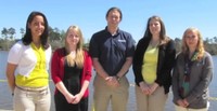 Forest monitoring from space is made possible by special sensors aboard orbiting satellites. The ForWarn forest monitoring tool relies on MODIS sensors to collect data that researchers can use to calculate the Normalized Difference Vegetation Index (NDVI), or measures of vegetation greenness. The MODIS sensors were originally designed to have a six-year life span, but are now operating beyond those years. As part of the NASA DEVELOP program, Center research ecologist Bill Hargrove partnered with NASA Stennis Space Center and students from the University of Southern Mississippi to test new methods for satellite data collection and NDVI calculation using a new sensor that monitors weather and climate patterns, known as the Visible Infrared Imaging Radiometer Suite (VIIRS). The students summarized the project in a video, which won a NASA DEVELOP “Best in Category” award. ForWarn researchers will continue to assess the use of VIIRS data to calculate NDVI and produce maps of forest development, disturbance, and recovery.
