
Forest ThreatNet
Where Has All the Water Gone?
GIS Specialist Connects Present Water Use to Future Needs
By Bridget O'Hara, NEMAC and Karin Lichtenstein, NEMAC
 Climate change. Population growth. Water supply stress. Carbon sequestration. Researchers at EFETAC’s Southern Global Change Program (SGCP) in Raleigh, NC, find themselves tackling large amounts of data in order to examine how all of these factors work together. This effort results in better and more efficient methods of managing southern forests, which are expected to face many changes in the next century. Organizing all of these data into an easily understood and analyzed format is the task of SGCP’s resource information specialist Jennifer Moore Myers. Drawn to this work by a love for forested landscapes and the enjoyment of being outdoors, she now plays a significant role in SGCP’s work. Moore Myers creates relational databases and uses Geographic Information Systems (GIS) to help researchers understand and explain how changes in the environment over time affect the growth of individual tree species and subsequently entire forests. As a GIS specialist, she is able to tie these data together and help researchers see complex patterns of ecosystem response to environmental stress.
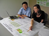
Above right: SGCP resource information specialist Jennifer Moore Myers and hydrologist Ge Sun discuss a model related to water research.
Moore Myers, who has a bachelor’s degree in environmental geography and a master’s in forestry and spatial information science, has always loved plants and learning about their complex environmental interactions. She shares that, "One of the most important environmental changes that can occur is a change in precipitation and water use." Moore Myers has gone to great lengths to find water use data from every possible source in the South for SGCP’s Water Supply Stress Index (WaSSI) model. Beyond looking at the average use of water by households, she is collecting data from water resource regions, state water managers, and commercial water users. In fact, some of the largest water users are energy producers, such as electric cooperatives and energy giants like Progress and Duke Energy. Data from these groups help to determine the amount of water that is used throughout the year and how that amount changes with population growth. Changes in available water directly affect plant growth and other changes in forests.
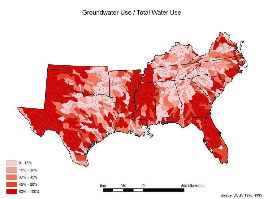 With a relational database of water use and water supply, Moore Myers can integrate climate change and population growth projections with the water balance model created by SGCP team leader Steve McNulty and hydrologist Ge Sun. The integration of these models allows SGCP to predict ground water supply expectations for a large region and even develop predictions several years or decades into the future. She then uses the relational database and the modeled data to map water, climate change, and population projections, and is able to indicate how frequently specific areas of the country will be water stressed in the months and years to come.
Above: Map shows percentage of total water use comprised of groundwater for 8-digit HUC watersheds in the southern US. (Source: US Geological Survey)
This research effort by Moore Myers and her SGCP colleagues can help clearly indicate stress on the common water supply and offer forest, municipal, and regional water managers a tool to address environmental change in their region. In this modern age of environmental change, any tool that takes the guess work out of natural resource management is greatly appreciated.
« Previous page Next page » Return to contents
