
LanDAT: the Landscape Dynamics Assessment Tool
PARTNERS: Oak Ridge National Laboratory; University of North Carolina Asheville's National Environmental Modeling and Analysis Center; Greater Appalachian Conservation Partnership
 SUMMARY: Monitoring forests, grasslands and other natural landscapes is a way to stay ahead of threats and assess management and conservation progress. Although land management objectives, social values, and ecological realities differ from place to place, all lands, regardless of ownership, face threats stemming from disturbances such as wildfire, climate extremes, invasive species, and changes in land use. Consequently, many treasured places are changing or can expect to change noticeably over the coming century. National imperatives such as the National Cohesive Wildland Fire Management Strategy (Cohesive Strategy) strive to restore and maintain resilient
 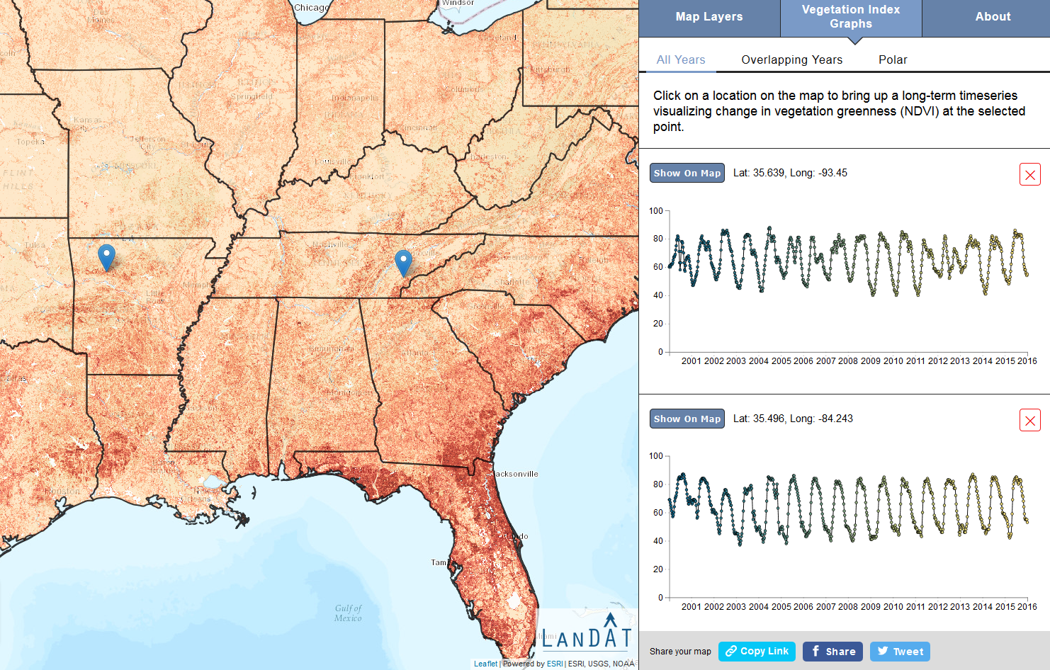 landscapes and adaptable communities (USDA Forest Service and USDOI, 2014). However, judging success or even progress toward such goals requires objective, quantifiable, and rigorous means of defining and measuring landscape resilience through time. Eastern Threat Center researchers have developed a set of computer-assisted tools to monitor all lands across the conterminous United States and provide a comprehensive year-to-year perspective on
 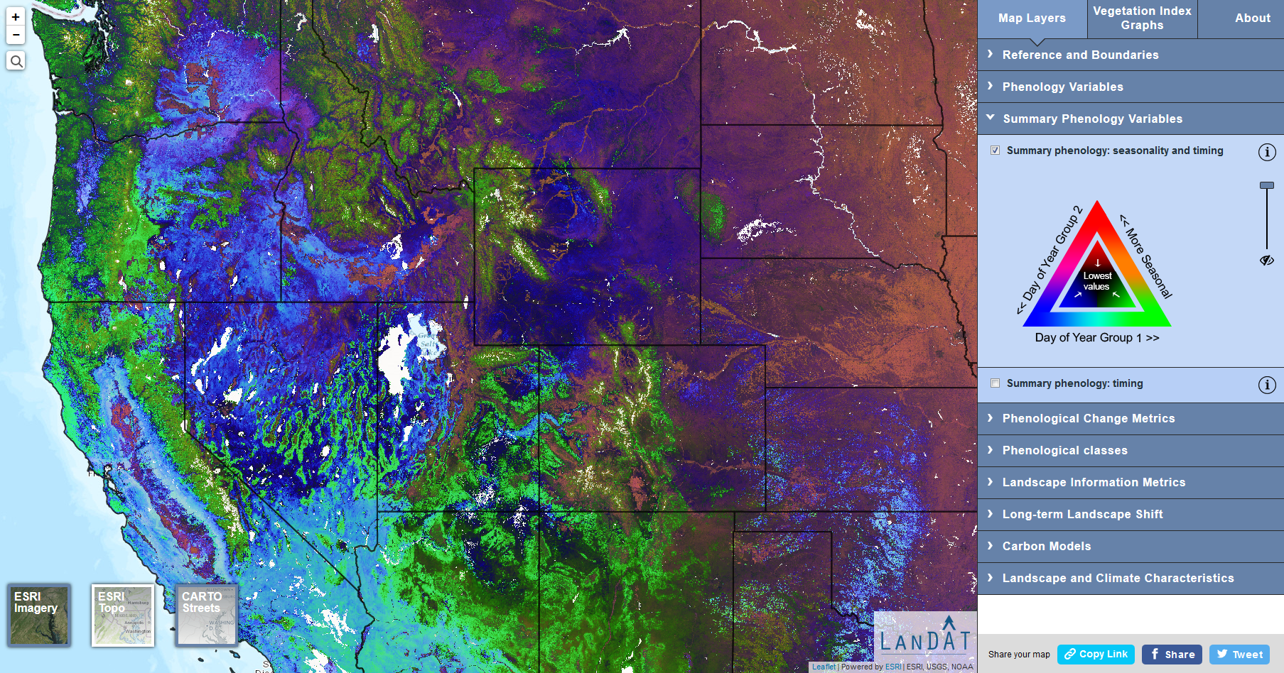 emerging landscape dynamics. The goal is to provide managers with a set of accessible, cost-effective tools for characterizing landscapes and landscape change across multiple scales. This provides a context for measuring the influence of management activities on landscape resilience and adaptive capacity.
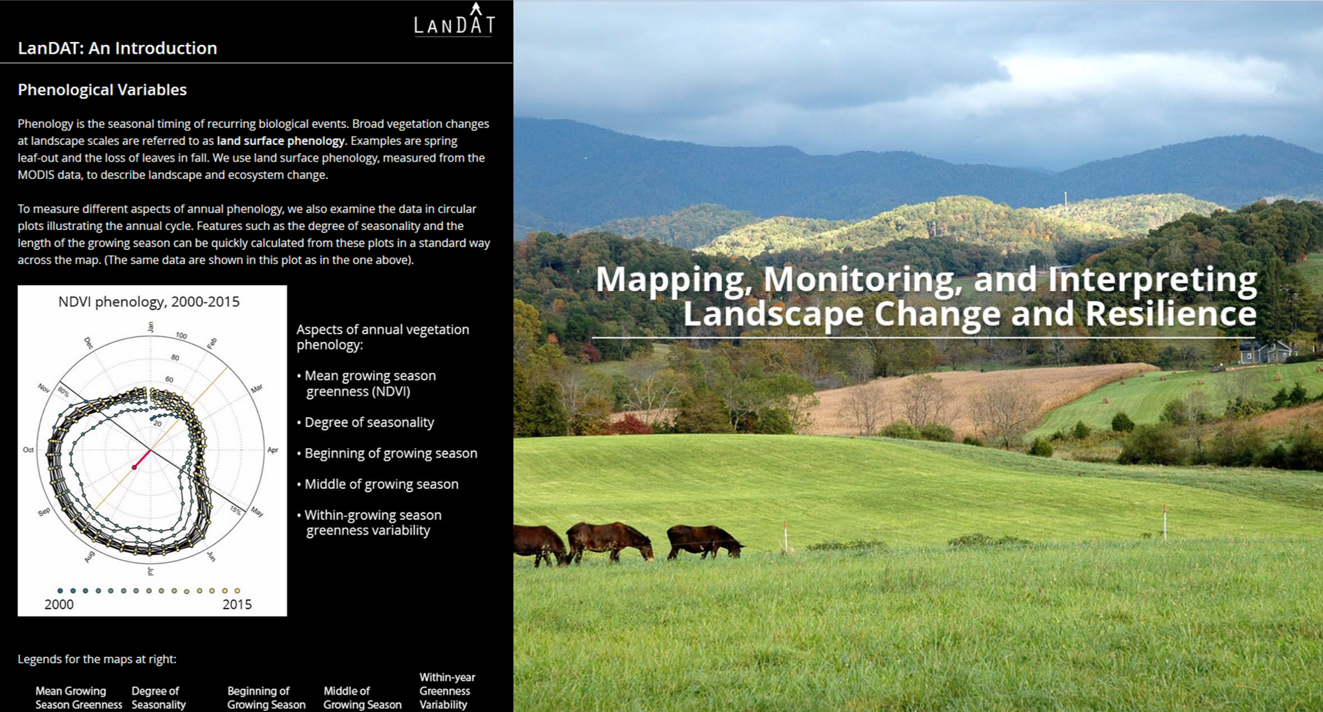
Pictured: LanDAT helps users monitor landscapes through more than 15 years of satellite observations (left). Its map layers can be used for evaluating any land unit in the continental United States (bottom right). A LanDAT overview (top right) guides users through key concepts and examples. Click images to enlarge.
Through just a few years of rapid development, Eastern Threat Center researchers developed the innovative Landscape Dynamics Assessment Tool, or LanDAT, for rigorously measuring and tracking ecological landscape dynamics. With partners, the Threat Center released the LanDAT website in 2017 and hosted multiple user workshops and other outreach activities, and continues to build and improve this tool. LanDAT resulted from the fusion of three components: 1) a massive Earth observation data set derived from the Moderate Resolution Imaging Spectroradiometer (MODIS) satellite system; 2) advanced computing and data analytic techniques developed by the Eastern Threat Center, NASA Stennis Space Center, and Oak Ridge National Laboratory; and 3) new methods for quantifying landscape vegetation change integrated with measures of ecosystem growth and development that were proposed and refined by Robert Ulanowicz (1986, 1997).
EFETAC'S ROLE: This project is supported by Eastern Threat Center research.
STATUS: Ongoing
PROGRESS: The approach to assessing landscape dynamics and long-term change is being applied to study a variety of landscapes across the nation through pilot projects and several forthcoming research publications.
LINKS:
Landscape Dynamics Assessment Tool (LanDAT)
PUBLICATIONS:
Using land surface phenology and information theory to assess and map complex landscape dynamics
Quantifying seasonal patterns in disparate environmental variables using the PolarMetrics R package
CONTACT:
Danny C. Lee, Eastern Threat Center, danny.c.lee@usda.gov or (828) 257-4854
Lars Pomara, Eastern Threat Center, lazarus.y.pomara@usda.gov or (828) 257-4357
Updated June 2018
