
A Global Classification of Contemporary Fire Regimes
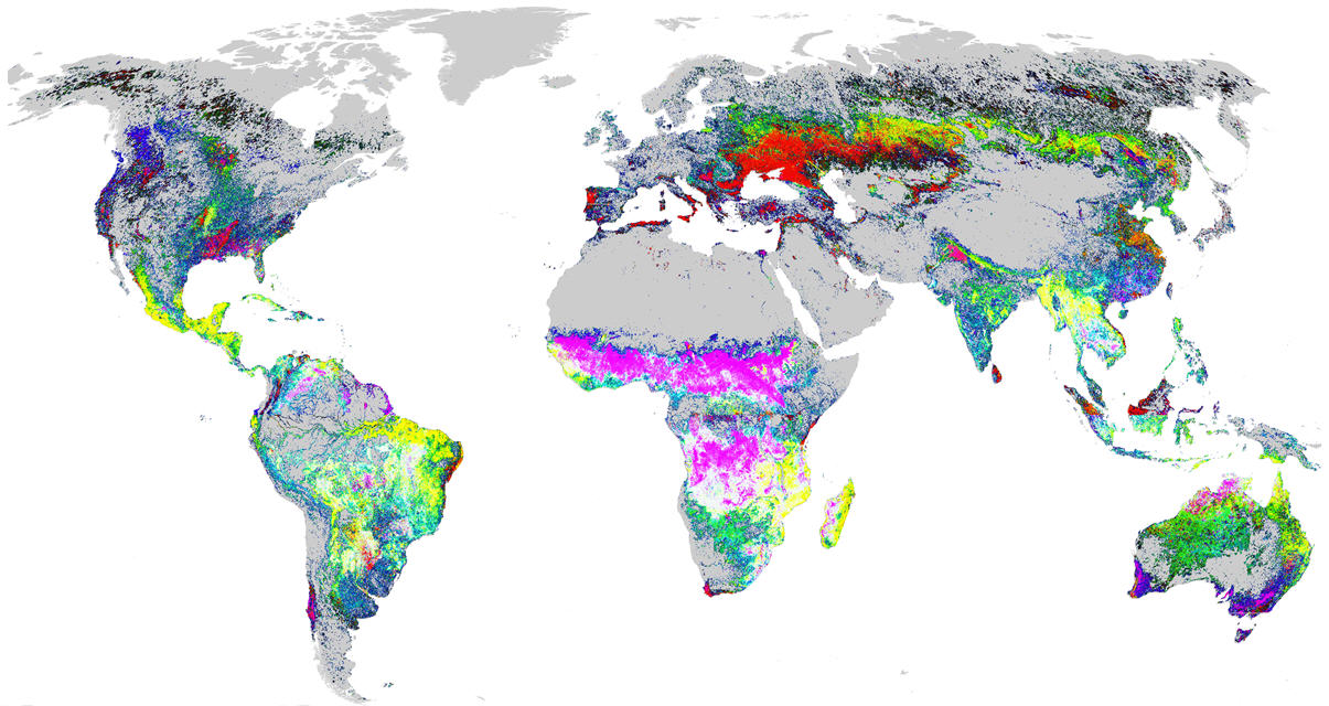 Eastern Threat Center researchers, in cooperation with colleagues at Oak Ridge National Laboratory, have devised a new method to identify and map global fire regimes from wildfires and human-caused fires (including prescribed fires, agricultural fires, and land-clearing fires) on all land cover types. Using the second-fastest supercomputer in the world, they clustered all of the thermal “hotspots” collected by two satellites passing over the Earth four times daily for 14 years. From this very large dataset, the researchers grouped hotspots into map cells to reveal the 1,000 most-different global fire regimes based on annual regularity, seasonality, fire temperature, and a general estimate of how much fire has been observed since 2000. The researchers then transformed all fire dates into Northern Hemisphere seasonal equivalents, allowing for cross-hemisphere recognition of the same seasonal fire regime. Finally, researchers used a statistical process to color the 1,000 global fire regimes, representing similar regimes with similar colors and using gradients of slowly changing colors to show the distinctions between each separate fire regime. The map provides a synoptic perspective of the complex patterns of fire characteristics across the entire planet, allowing users to recognize and compare diverse types of global fire regimes.
Right: The new global fire regimes map shows "burnability/hotness” in red, "fall/early winter fires" in blue, and "late winter/spring fires" in green. Gray areas did not have enough fires to have a distinct fire regime. Click to enlarge.
External Partners/Collaborators: Oak Ridge National Laboratory
Contact: William Hargrove and Steve Norman
