
Researchers Devise a New Way to Crunch Massive LiDAR Data to Map Forest Structure
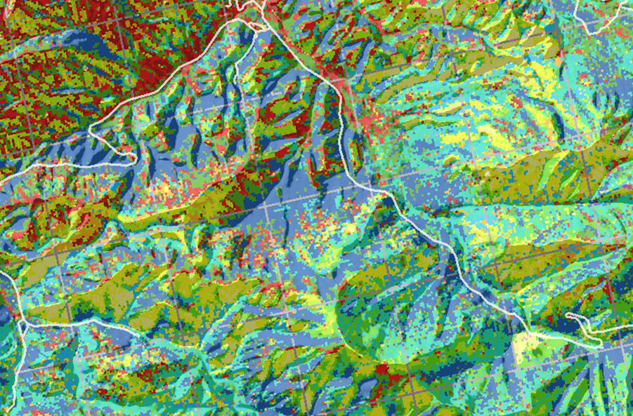 As forests change from all manner of stressors, monitoring forest structure becomes particularly difficult. While airborne LiDAR data have improved the accuracy of surface maps and improved canopy height estimates, only a fraction of the above-ground data available are actually being used. Broad-scale mapping of forest structure has been limited by large datasets and processing requirements and the lack of a readily-understandable approach for characterizing different structural types, so the potential insights into forest structure from LiDAR technology are usually under-utilized. Now, a team of researchers from the Eastern Threat Center, U.S. Fish and Wildlife Service, and Oak Ridge National Laboratory has joined forces to develop a new way to map forest structures at the landscape scale. With help from the world’s second fastest supercomputer, researchers have developed a statistical clustering algorithm to group together all forest areas that have similar vertical aboveground structural profiles, which greatly simplifies the depiction of these complex data sets for foresters and habitat biologists interested in this information. Researchers focused on the portion of the Great Smoky Mountains National Park located in Tennessee—which includes some of the most complex forests of the eastern United States—to create forest structure maps with this new method.
Right: A map shows different forest structural groups in different colors, draped over a hillshaded elevation model. Click to enlarge.
External Partners/Collaborators: U.S. Fish and Wildlife Service; Oak Ridge National Laboratory
Contact: Steve Norman and William Hargrove
