
Satellite-based mapping tools reveal forest disturbances with extraordinary clarity
Innovative remote sensing tools developed by USDA Forest Service scientists now capture forest disturbances better than ever, just as severe weather and defoliations become big news. Recent mapping successes in the eastern US include a nine-state Lymantria moth outbreak and extreme weather. These monitoring efforts help support traditional forest disturbance mapping which has become more difficult due to Covid-19 restrictions.
 From its inception, forest disturbance mapping has been inefficient due to the division of mapping responsibilities across various federal and state agencies. Remote sensing has long offered hope that monitoring can become more integrated. Forest Service scientists at the Southern Research Station are working toward that long-held goal through two remote sensing products that rely on a combination of frequent-but-coarse imagery for general surveillance, and less frequent-but-detailed imagery. This technology has been put to the test recently as extreme weather has beleaguered the eastern US.
The science team collaborated with additional Forest Service partners to improve the way that state and federal agencies monitor hurricane impacts in the Southeast using both ForWarn and HiForm maps of change. In spring 2021, the team mapped extreme freeze events in Missouri and Arkansas better than these poorly understood disturbances have ever been mapped—such spring freezes may become more frequent in the future with climate change. Coordinated use of ForWarn and HiForm proved itself again with a massive Lymantria moth outbreak that erupted in nine states and Canada. Observations from the field confirmed the accuracy of the technology for mapping these outbreaks, with implications for how such defoliations are routinely mapped moving forward.
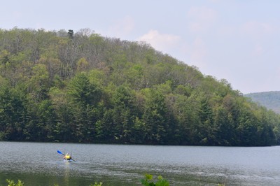
Pictured: Lymantria moth defoliation in the Michaux State Forest, Pennsylvania during July 2021 was well captured by satellite imagery using both ForWarn and HiForm mapping products. USDA Forest Service image.
