
2011 Research Highlights
Improving Fire Modeling Tools for the Eastern United States
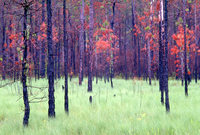
Risk maps help fire managers understand hazards and uncertainties
 Fire behavior models often perform poorly in the East relative to the West because fuel maps are highly inaccurate and models were not designed to deal with seasonal canopy dynamics that characterize eastern deciduous forests. To address this problem, EFETAC scientists and collaborators are improving the reliability of existing fuel maps for the southern and central Appalachians using a range of remotely sensed data including satellite imagery, aerial photography, and LIDAR. These fuel maps will be more accurate than existing maps and will retain uncertainties of fuels classifications to represent fire hazards and risks. Other uncertainties to be modeled include climate conditions when fires burn, seasonal attributes of canopy cover, and pattern of ignitions based on historical datasets.
These fire risk maps will improve scientists’ understanding of likely fire regime responses to future climate, how the quality of information used in modeling affects results, and risk perception. This information will be useful for fire managers who require more reliable fire modeling tools and better understanding of predictive modeling limitations. Multiple fuels classifications will also be produced using a range of information sources to help decision makers weigh costs with the relative value of information derived from various remote sensing technologies.
Contact: Steve Norman, research ecologist, (828) 259-0535, steve.norman@usda.gov
