
2013 Partnership Highlights
ForWarn Forest Monitoring Tool and Partners Receive High Honors
Collaborative efforts recognized for advancing forest monitoring across the nation
 ForWarn is a forest monitoring tool that uses satellite imagery to produce weekly snapshots of vegetation conditions across the lower 48 United States. Scientists with the Eastern Forest Environmental Threat Assessment Center and the Pacific Northwest Research Station Western Wildland Environmental Threat Assessment Center developed ForWarn in collaboration with researchers from NASA Stennis Space Center, US Geological Survey EROS Data Center, University of North Carolina Asheville’s National Environmental Modeling and Analysis Center, and US Department of Energy’s Oak Ridge National Laboratory. These collaborations result in more efficient data acquisition, processing, and product delivery in addition to efforts to improve disturbance monitoring and provide outreach to local, state, tribal, and federal forest managers when disturbances are detected.
ForWarn and its collaborators have been recognized regionally and nationally for success in providing forest managers with an efficient, user-friendly, and rapid assessment tool for monitoring the location and severity of disturbances from a variety of causes, including tornadoes, hailstorms, hurricanes, wildfire, insects and disease, development, and severe drought. The ForWarn team was awarded the Southern Research Station Director's Award for Excellence in Science Delivery, the NASA Group Achievement Award, the Oak Ridge National Laboratory Computational Science and Mathematics Division's most distinguished scientific or technical contribution award, and the national and southeast regional Federal Laboratory Consortium for Technology Transfer’s Interagency Partnership Awards.
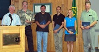
Right: Members of the ForWarn team accept the Federal Laboratory Consortium for Technology Transfer’s National Interagency Partnership Award.
Forest Service Partners/Collaborators: Western Wildland Environmental Threat Assessment Center, Forest Health Protection, Remote Sensing Applications Center
External Partners/Collaborators: NASA Stennis Space Center, University of North Carolina Asheville’s National Environmental Modeling and Analysis Center, US Geological Survey EROS Data Center, US Department of Energy Oak Ridge National Laboratory, state forestry agencies
Contact: William W. Hargrove, Eastern Threat Center research ecologist, (828) 257-4846, william.w.hargrove@usda.gov
