
Predictive Models Aid Detection of Illegal Marijuana Grow Sites
The problem of illegal marijuana farms on national forests is growing. From a nationwide map of grow sites, researchers developed predictive models that reveal how drug markets, policies, and environmental conditions influence growers’ decisions for the location of grow sites. The models are now used to construct regional maps of grow site likelihood.
 Marijuana (cannabis) is now legal in California and other parts of the United
States for medicinal and recreational use, but illegal marijuana growing is
still a billion dollar industry with international tentacles and serious
ecological consequences. An Eastern Forest
Environmental Threat Assessment Center researcher and partners built predictive
models using data describing 2,322 cannabis grow
locations and a variety of scenarios including cannabis market prices, law
enforcement density, and socioeconomic, demographic, and environmental
variables. The models were used to estimate grow site likelihood, which allows agencies
to focus law enforcement resources and potentially increase success of illegal
grow site discovery. As shown by the predictive models, future adjustments in
state cannabis laws or prices could affect cultivation decisions on national
forests. The study was published in the journal Ecological Economics.
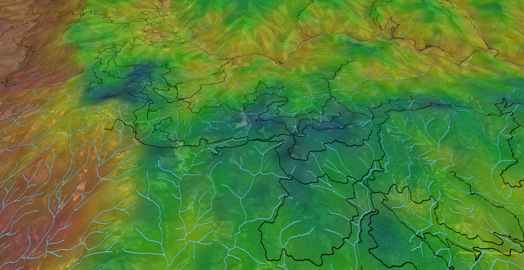
Marijuana (cannabis) is now legal in California and other parts of the United
States for medicinal and recreational use, but illegal marijuana growing is
still a billion dollar industry with international tentacles and serious
ecological consequences. An Eastern Forest
Environmental Threat Assessment Center researcher and partners built predictive
models using data describing 2,322 cannabis grow
locations and a variety of scenarios including cannabis market prices, law
enforcement density, and socioeconomic, demographic, and environmental
variables. The models were used to estimate grow site likelihood, which allows agencies
to focus law enforcement resources and potentially increase success of illegal
grow site discovery. As shown by the predictive models, future adjustments in
state cannabis laws or prices could affect cultivation decisions on national
forests. The study was published in the journal Ecological Economics.
Pictured: A map shows the likelihood of illegal grow site establishment (red=high, blue=low) based on multiple factors that illegal marijuana growers take into consideration when deciding where to locate their farms. The blue and black lines depict streams and roads, respectively.
Related publications:
Forest Service Partners/Collaborators: Southern Research Station, Pacific Northwest Research Station, Forest Service Engineering
Contact: Frank Koch, Research Ecologist, frank.h.koch@usda.gov
